There was a time in my life when biking was very simple. I ran outside, picked up my bike, and peddled like the devil. I didn’t have a destination. Or a master purpose. I just peddled.

Growing up, we lived next door to a church. It had a giant gravel parking lot that made the perfect oval track for racing, with the church in the middle. I would ride around that path, oval after oval, for hours on end. One of my favorite photos of me as a kid shows me at around seven or eight, riding my older sister’s bike around that church, hands in the air, braids flying. All with a irrepressible smile.
![]()
Now, of course, I need more from the experience. I’m pretty sure if my neighbors saw me out riding in circles in our cul de sac, they would ask Tara if I was having a mental break. And, in fairness, I probably would be.
There’s a lot of tech that goes with riding a bike now. Not only does a person need the right gear to wear, and the right bike to ride, a person also needs the right software to track the experience.
In our world of smart phones and gps, there are a lot of options.
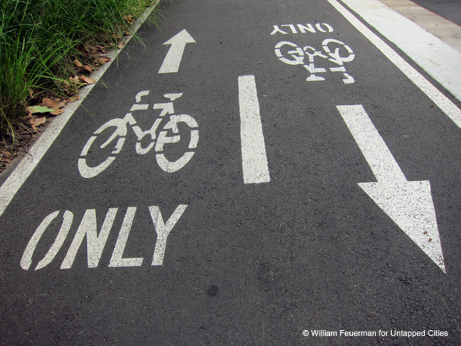
One of my favorites is Google Maps. There is a bicycling option for the map settings, and it’s an excellent tool for planning a ride. It shows dedicated use trails, roads with demarcated bike lanes, as well as bike-friendly roads. Bike-friendly can mean a few different things. Option one is a very low traffic road, such as an old highway that’s been replaced by a modern alternative. Option two is surface street that winds through a neighborhood. Option three is a bit of a hybrid. Some cities, like mine, dedicate through roads as bike routes. They specifically search out longer stretches of lesser used roads and mark them with bike specific guides for navigating through the city. The big downside of Google Maps is, while it’s great for planning a ride, it doesn’t have the ability to track a ride once you’ve started peddling.

Mapmyride is an app that’s available for droid system phones and iPhones. I’ve used this one quite a bit and I like what it offers. As with most phone apps these days, it can be used in conjunction with social media. That’s kinda fun if you want to show family and friends what you’re getting up to. Like Google Maps, you can plan your ride using designated bike routes. The big appeal of this app is you can use it to track a ride in progress. Then, at the end of your ride, it will give you a detailed breakdown of how the ride went, including your average speed, high speed, duration, and changes is altitude (how many hills did you climb). Additionally, if it’s a ride you take a lot, you can name the route and compare statistics. This is especially helpful for riders who are training for a competitive event or a distance ride.
Bikemap is another option. By design, it depends upon rider interaction for it to work. Yes, you can see existing dedicated bike routes, but they’re not nearly as easy to distinguish in this app as they are in Google Maps or Mapmyride. However, as any dedicated biker knows, there are many, many excellent rides available in any city that aren’t marked on a bike trail map. This is where Bikemap excels. The prime selling point is that local riders can share their favorite rides. So, if you’re looking for a new possibility, this is a great place to look. And, if you’re the sort who likes to share the goodness in your life with others, you’ll get a kick out of uploading your favorite ride for others to try.
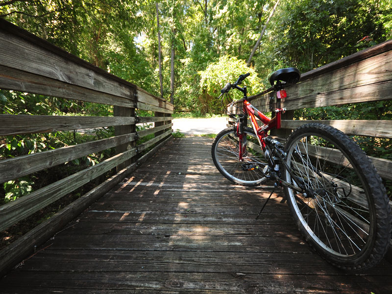 In the quest to find the perfect bike riding experience, I’d be completely negligent if I didn’t mention Rails-to-Trails Conservancy. I’ll go into more detail about these guys because what they’re doing is amazing, but the short version is thus: Rails-to-Trails works primarily to convert old railroad shipping tracks to bike trails. Some of my very best rides have been on one of their trails. They’re working to reclaim routes all over the US and turn them into viable recreational biking trails. The results are amazing. Here’s one of my favorites: Banks-Vernonia State Trail.
There’s much, much more I could say on this topic, but it’s a beautiful day. The longer I spend on the computer typing about riding, the less time I have to spend on an actual ride.
Happy peddling, y’all!